The Persistence of Subterranean Fluids
Finding a deep-water aquifer isn’t a matter of luck or a dowsing rod that’s been sitting in a garage since the Nixon administration. It is a calculated strike against the geological armor of the earth. My old journeyman used to say, ‘Water is lazy, but it’s patient.’ It will find the tiniest pinhole and turn it into a geyser given enough time. When you are looking for water at depths that haven’t seen the sun in ten thousand years, you have to be just as patient. You have to understand that the earth is a complex filter, and finding the sweet spot—the porous rock or the sand lens—requires more than just a rough-in mentality. It requires a forensic eye for the way minerals stack and how the weight of the overburden compresses the very veins of the planet.
1. The Electrical Resistivity of the Earth
Before you ever break ground or think about sweating a single copper fitting, you have to read the electrical pulse of the soil. Hydrogeological surveys in 2026 rely heavily on resistivity. Dry sand is an insulator; it’s stubborn and resists the flow of current. But water-saturated gravel? That acts like a conductor. We use probes to send a current into the ground, measuring the push-back. If the resistivity drops off a cliff, you’ve likely found your target. It’s the difference between hitting a dry pocket of dead clay and hitting the mother lode. You have to zoom in on the data. A slight variation in the ohm-meter could mean you’re looking at a brackish lens of salt-heavy silt rather than a fresh potable stream. The chemistry of the water dictates its conductivity. Deep water that has been leaching minerals from limestone for decades will hum with a different electrical signature than surface runoff that’s just passed through some topsoil and a bit of mulch.
“Where a potable water system is challenged by high mineral content or potential contamination, the hydrogeological assessment shall include a complete mineralogical profile.” – ASTM Standards for Subsurface Fluid Identification
2. Utilizing Vacuum Excavation for Subsurface Assessment
You can’t just go swinging a backhoe bucket in a sensitive urban environment and expect to find water without causing a disaster. I have seen too many ‘cowboys’ rip through a fiber optic line or a high-pressure gas main because they didn’t know what was three feet down. This is where vacuum excavation becomes the primary tool for the modern forensic plumber. By using high-pressure water or air to liquefy the soil and a massive vacuum to suck it up, we can expose the ‘skeleton’ of the site without the risk of mechanical damage. It’s called daylighting. When you’re trying to locate a specific borehole site, you need to see the stratigraphy. You need to see if that grey clay is actually a confining layer or just a localized deposit. The vacuum process pulls up the slurry and leaves a clean, surgical hole. No jagged edges, no broken pipes, and no black sludge from a nicked sewer line leaking into your clean dig. It is the most precise way to verify that your survey data matches the physical reality of the ground.
3. Borehole Integrity and Casing Strategy
Once you’ve identified the spot, the borehole drilling begins. This is where most guys fail. They think the hole is just a straw. It’s not. It’s a structural component of the water system. If the borehole walls collapse, or if you don’t use the right pipe dope on the casing threads, you’re inviting contamination. You need to zoom into the annulus—the space between the pipe and the earth. That space must be grouted with bentonite or a cement slurry to prevent ‘surface tracking.’ That’s when nasty surface water, full of nitrates and road salt, sneaks down the side of your pipe and ruins the deep aquifer. I’ve seen wells where the owner saved a few bucks on the grout, and within two years, the water smelled like a sulfur pit and had the clarity of weak tea. You have to ensure the screen—the part of the pipe with the tiny slots—is positioned exactly in the water-bearing zone. If you miss it by even six inches, your flow rate drops, and you’ll be staring at a dry tap during a drought.
4. Daylighting for Sustainable Infrastructure
When we talk about exploring daylighting benefits, we aren’t just talking about making holes. We are talking about the long-term health of the site. In dense urban areas, the ground is a mess of old lead pipes, abandoned clay sewers, and forgotten steam lines. Finding deep water in these environments is a surgical procedure. You use daylighting to confirm that your proposed borehole path doesn’t intersect with the ghost of a 1920s infrastructure project. I once saw a drill rig hit an old abandoned grease trap that wasn’t on any map. The smell was like a combination of rotting meat and wet basement. It took weeks to decontaminate the site. By using non-destructive excavation, you map the ‘forbidden zones’ before the heavy machinery arrives. It’s about respect for the history of the ground and the physics of the job.
“All potable water wells shall be constructed such that the source of water is protected against contamination from any surface or subsurface source.” – IPC Section 602.3.1
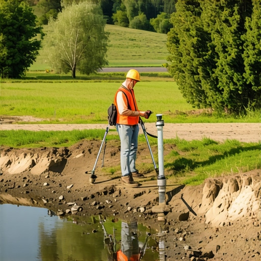
5. Selecting Professional Site Services
Don’t hire a guy with a shovel and a dream. You need site services that understand the hydraulic pressure involved in deep-well extraction. This isn’t just about the pump; it’s about the total dynamic head and the friction loss in the pipes. If you’re pulling water from 400 feet down, that water is heavy. It puts immense stress on every Fernco coupling and every valve in the system. You need technicians who know how to set a pitless adapter so it doesn’t leak and how to install a proper cleanout so the well can be treated later. In 2026, we are seeing more expansive soil issues than ever. Clay shifts. It shears copper pipes like they’re made of wet cardboard. A pro service will account for this, using flexible connections and proper bedding material to ensure the system survives the earth’s natural movements. IMAGE_PLACEHOLDER
The Final Word: Water Always Wins
At the end of the shift, when the mud has dried on your boots and the smell of wet earth is stuck in your nostrils, you realize that you aren’t in control—the water is. We are just trying to build a safe path for it to travel. Whether you’re sweating a joint on a new stack or monitoring the torque on a drill string, the principles are the same: precision, patience, and a deep hatred for the ‘hack’ way of doing things. If you cut corners on your hydrogeological survey, the earth will find your mistake. It might take a week, or it might take ten years, but that mistake will turn into a leak, a clog, or a collapsed well. Do it right the first time, use the right tech, and respect the physics. Buy it once, cry once. That’s the code of the forensic plumber.
This article really nails the importance of a meticulous approach when it comes to hydrogeological surveys. I appreciate the emphasis on using non-destructive methods like vacuum excavation; in my experience, this can save a lot of headache down the line, especially in urban environments with old infrastructure. One point I found particularly interesting was the focus on the soil’s mineralogical profile—knowing the mineral content doesn’t just help in locating water, but also in planning for treatment and long-term maintenance. Have others encountered unexpected mineral content during their projects that complicated the process? Personally, I’ve seen cases where high mineralization required switching to different filtration systems after initial drilling. It makes me wonder if integrating real-time monitoring of water chemistry during extraction could further improve outcomes—what do you all think about incorporating continuous analysis as a standard practice? Overall, this post reinforces that patience, precision, and proper technology are the keys to success in water exploration.